Real Cases, Proven Results
Below is a summary of some past cases & testimonials as a weather expert.
From a U.S. District Judge
“The Court finds that Dr. Bunkers’s testimony is based on a reliable methodology and supported by sufficient data such that his testimony is admissible under Rule 702.” (March 2025)
Blowing snow and slip and fall(s)
Two separate slip and fall events, involving the same person at two different locations, occurred at a business in “rural” areas about one month apart from each other. An analysis of (i) photos provided by defense, (ii) road-condition reports and webcams, (iii) snow depth, snow age, temperature, and wind data, (iv) the accumulated winter season severity index, and (v) peer-reviewed publications on blowing-snow made it evident that blowing snow more likely than not was occurring near the time of the slip and fall events. Therefore, this case was settled shortly before going to trial.
We were able to get this case settled, so you can take the March 18-21 trial off your calendar. I truly appreciate your assistance on this file and look forward to working with you in the future. Thank you!
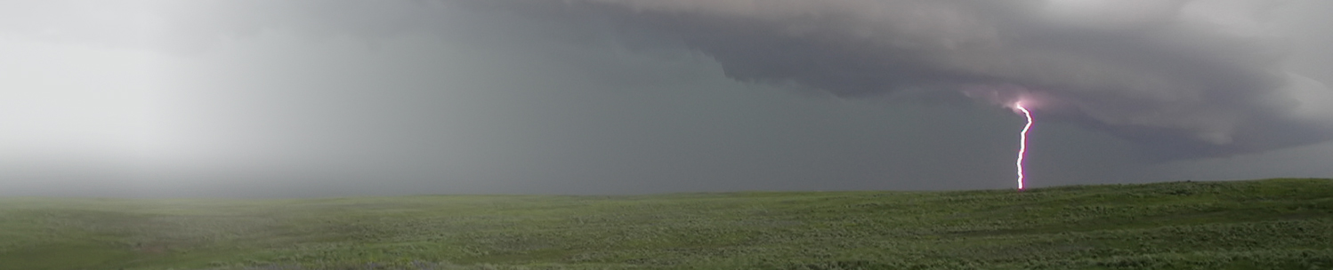
Strong winds and personal injury
Strong winds (with gusts to near 50 mph) occurred for about 15 minutes prior to a large tree limb falling on a person doing outdoor activities in a mobile-home park, resulting in a lawsuit. Evaluation of radar, satellite, and GOES & NLDN lightning data also revealed that showers and thunderstorms were in the vicinity of the mobile-home park at that time. Multiple surface weather observation stations around the accident location, along with wind information from a regional weather balloon launch, support the wind analysis. Moreover, the forecast included gusty winds, showers, and thunderstorms for the mobile-home park. As a result, it was clear that outside activity was not warranted in these weather conditions, and thus the case was resolved at mediation.
You were fantastic and [prepared] a wonderful report! It settled because of your hard work.
Dust storm and multi-vehicle accident
A large dust storm affected a main highway that passes through a rural area. There was a multi-vehicle accident that involved cars and semi-trucks, resulting in lawsuits. Two of the main questions pertained to the (i) source of the dust and (ii) timing of the dust with respect to the vehicles. To answer these questions, 1-minute rapid-scan data from the Geostationary Operational Environmental Satellite-16 (GOES-16) were used to create red-green-blue (RGB) composite imagery to highlight areas of dust. This analysis showed the source region of the dust and identified when the dust affected the accident location and associated vehicles. Additional information on drought, recent snowfall, and wind gusts further clarified the nature of the dust storm. As a result of these findings, the case settled well before going to trial.
I really appreciate your assistance on this case. I think the information that you provided played a big role in getting the case settled and I hope to work with you again in the near future.
Hailstorm and residential damage
A hailstorm affected a broad swath across a residential area. The insurance company declined to pay for damages because hail was not reported specifically at the property of interest. Therefore, a detailed analysis of all storm reports and radar information from two radars was needed to show that (i) hail reports of 1 to 1.75 inches occurred around the property of interest, (ii) radar signatures were consistent with a severe hail-producing storm at the property, and (iii) hail size likely was underestimated and/or larger hail could have gone undetected according to peer-reviewed literature on hail-reporting procedures. As a result of this report, the insurance company agreed to pay for the hail damages to this property.
It’s been a pleasure working with you. Having your report as part of the file was definitely crucial.
Preexisting ice and slip and fall
A slip and fall occurred at a business about five hours after a light dusting of snow obscured preexisting ice. An analysis of (i) four nearby weather stations with varying types of data and (ii) high-resolution satellite images made it clear that considerable snow melted several days prior to the slip and fall during a freeze–thaw cycle. This was followed by a cooling trend in the few days prior to the slip and fall, keeping the ice in place. Opposing counsel claimed that an ice storm occurred on the day of the slip and fall, but this was demonstrably false and based—in part—on faulty weather information (similar to this example). This case settled a little over a month after I issued my report.
Matt, we just got this matter resolved. As a result, your deposition is cancelled. Thank you so much for your help. … Your report was very helpful and well done. If we need a meteorologist in the future, you are on the top of the list.
Fog and car/tractor-trailer collision
Patchy, dense fog resulted in a car/tractor-trailer collision shortly after sunrise in a rural area. The car was traveling south in an area with patchy fog while the tractor-trailer was traveling east in dense fog. As the tractor-trailer pulled out into a major highway, the car collided with it. Using surface and upper-air observations along with terrain information, it was shown that the fog was shallow. Furthermore, an analysis of GOES-16 satellite data—in combination with police dashcam video—helped confirm the areas of denser fog. This revealed that the car did not encounter the dense fog until right before the collision, indicating the car driver was not at fault. Thus, the parties were able to reach a resolution before going to trial.
Thank you again for your assistance; your help was greatly appreciated. I look forward to working with you again sometime.
High winds, drought, and wildfire
A combination of weather and climate conditions conspired to produce a large wildfire in rugged terrain as strong winds blew a tall tree over a powerline. Opposing counsel claimed the winds were not unusual and the tree should not have failed. However, several datasets were evaluated and revealed that a downslope windstorm produced localized gusty and erratic winds that were unusual for that area (i.e., in the top 99th percentile), with gusts possibly as high as 70–75 mph at tree top. Prior drought conditions, a lack of snow cover, dry fuels, continued strong/gusty winds, and the time of year allowed for the fire to spread and grow out of control. This analysis helped lead to a settlement before the case went to trial.
Thank you for your great help in the case. I have no doubt the successful result was achieved in large part due to your analysis and report. It was a pleasure working with you.
Heavy rain and flooding of a fourplex
Three rainstorms over a 3-year period led to flooding of a fourplex in a major city. A lawsuit against the city claimed the drainage was insufficient for the rainfall. Thus, radar rainfall estimates were combined with nearby rain gauge data and compared to rainfall recurrence intervals. The first storm produced over 7 inches of rain in less than 24 hours, making it a 350-year rainfall event (0.29% annual probability). The second storm produced 3 inches of rain in an hour (100-year rainfall event; 1% annual probability). Finally, the third storm occurred only 5 days later, and was a 25-year rainfall event. Moreover, rainfall over the preceding 60 days was equivalent to a 100-year storm. The defense was therefore able to get the case dismissed.
We prevailed on our motion for summary judgment. Your report was extremely helpful in doing so. Thanks again for all of your help.
Tornado/winds and pole-barn damage
A severe “supercell” thunderstorm with straight-line winds and a possible tornado damaged a pole barn in a rural area. There was a dispute about the maximum wind gusts as well as a possible tornado regarding the insurance claims. Using the three nearest radars, signatures related to damaging thunderstorm winds and tornadoes, official storm damage reports and surface observations, an EF-scale damage assessment of available photographs, a high-resolution satellite analysis, and the climatology of tornadoes in this area, it was determined that downburst wind gusts reached from 75 to 95 mph. Furthermore, the possibility of a short-lived tornado was estimated at 50%. This analysis led to a settlement before the case went to trial.
This case could not have been successfully resolved without your efforts. I appreciate the work you did for me in this case. I hope we are able to work together again in the future.
Severe weather and irrigation-system damage
A severe thunderstorm brought wind-driven hail and tornadoes to an agricultural area, damaging crops and irrigation systems. A farmer brought forth an insurance claim, stating that a tornado damaged his center-pivot irrigation system. This assertion was based, in part, on neighbors who received insurance payouts for their damage. However, an analysis of storm data and storm survey reports, radar data and tornado signatures, and high-resolution satellite data revealed that no tornado affected this particular irrigation system. Instead, wind-driven hail was shown to be the cause of the damage, which was not directly covered. This helped the insurance company show that the damage was not produced by a tornado.
Yes, [your weather information] was helpful! Your work got them to make admissions in their depos…and they testified at trial consistently. Thank you for your good work.
Tornado/winds and city-building damage
Severe storms brought straight-line winds and multiple tornadoes to a city, causing considerable damage. For one particular building, the insurance company refused to pay for damages because they claimed the winds were too weak and the building was poorly constructed. However, a detailed examination of storm photos, drone video, and eyewitness reports indicated that damage was substantial and debris was strewn in multiple directions—consistent with a tornado. In addition, a careful radar analysis revealed a “tornadic debris signature” over the area of interest, suggesting a tornado affected the area. Wind gusts of 90–100 mph were estimated (EF1 damage), which prompted the case to settle before going to trial.
We were able to get this one settled before the end of the new year. Thanks!
Hailstorms and crop insurance
Hailstorms affected wheat crops at two separate locations, and the size and timing of the hail was needed to assist with an insurance claim. Because no official hail reports were available at the two locations, the insurance company was disinclined to pay the claims. Upon examination of radar data from three sites, radar limitations (e.g., beam blockage), surface observations, and available storm reports, it was determined that “supercell” thunderstorms with damaging hail affected both properties. Furthermore, the insurance company’s weather report was dubious because it was inconsistent with the observed hail and wind reports. This analysis helped lead to a settlement before the case went to trial.
Thanks for your help, you did excellent work and I would not hesitate to use you again or recommend you should the opportunity arise.
Wet weather and mining operations
Very wet ground over a 2-year period led to saturated conditions in an area where mining operations are conducted. Complaints were lodged against the company for improper mining operations that caused excess runoff. However, when considering the previous four years of precipitation and the differences of that precipitation from normal/average (along with streamflow and soil moisture percentiles), it was shown that a 2-year dry period was followed by a 2-year wet period. This, in combination with two spring blizzards and cold temperatures near the end of this 2-year wet period, culminated in favorable natural conditions for excess runoff and flooding.
Looks great Matthew. Thanks again, and … I suspect I’ll call on you again!“
Fundraising event and snowfall insurance
Snow fell during a time when an organization had insurance for at least 5″ of snowfall to protect against losses for their fundraising event. Initial estimates by another consulting firm showed 4.6″ of snow during the period of interest, which resulted in denial of the claim. A more detailed analysis of snowfall reports (and their reliability), police reports, radar signatures, radar snowfall estimates and timing, and snow-to-liquid ratios (SLRs) and SLR changes with time, showed that snowfall very likely equaled or exceeded 5″ during the period of interest. This analysis resulted in full payment of the insurance claim.
On behalf of [the] … Board, I want to thank you again for all your work on this file. It truly made the difference.
Adverse weather and construction delays
Adverse weather occurred over a prolonged period that hampered construction for a very large school project. There was disagreement over the claimed number of lost days because of adverse weather. The opposition claimed that the number of days lost because of adverse weather was excessive. However, using a more representative climatology, a winter season severity index, verification of long-range outlooks, rainfall recurrence interval information, soil moisture anomalies, and high-resolution satellite information, it was shown that the period of interest was abnormally wet, snowy, and cold, and also not anticipated—thus, adversely affecting construction operations and planning.
My folks and I are pleased with the report you prepared.
Heavy snow and trip and fall
Heavy snow was associated with a personal injury on a business’s sidewalk, with snowfall rates of 1–2” per hour prior to the incident. The incident occurred around 4 am after 12” of snow fell, in an area where heavy snow like this is rare. There was a well-worn foot path through the snow, and opposing counsel claimed that the injured person tripped in a “hole” near or just outside of the foot path. Given the snowfall intensity, snow density, and the repeated traffic along the foot path, it is likely that snow was compacted into parts of the hole, thus making it questionable the hole was the ultimate cause of the incident. This analysis helped lead to a settlement before the case went to trial.
Thanks again for your help. We will call you if we have another weather issue come up.
Snowfall and slip and fall
Snow was associated with a personal injury on a store’s parking lot—three days after the snow event. Although snow was plowed during the snowfall event, additional snow fell later that same day, but it was not cleared until several days later. Opposing counsel claimed the additional snowfall was light (<2″) and that snow blew into the parking lot prior to the accident. However, human snowfall observations, combined with radar and automated observations, indicated that snowfall was at least 2″ after the initial snow was plowed. Also, winds were not strong enough to blow appreciable snow into the parking lot. This analysis led to a settlement before the case went to trial.
Thank you for your assistance regarding this matter. I look forward to working with you [again].
Rain intensity/visibility and automobile accident
Rain and/or mist were associated with an accident on an interstate highway. Opposing counsel claimed that only mist was ongoing at the time of the accident. However, upon examination of radar and lightning data, surface and upper-air observations, and publications related to radar-derived rainfall rates and visibility, it was evident that heavy rainfall occurred during and immediately preceding the accident, thus leading to relatively low visibility (and the possibility for hydroplaning). This analysis led to a settlement well before the case went to trial.
We have verbally agreed to a settlement in this matter. Thank you very much for all your help.
Outdoor event and rainfall insurance
Rain fell during a time when an organization had insurance for at least 0.25″ of rain to protect against losses for their outdoor fundraising event. Initial estimates by another consulting firm showed 0.14″ of rain during the period of interest, which resulted in denial of the claim. A more detailed analysis of radar rainfall estimates and the associated errors, along with nearby supplemental precipitation reports from several observers, showed that rainfall likely equaled or exceeded 0.25″ during the period of interest. This analysis resulted in full payment of the insurance claim.
You are the most tenacious and effective expert with whom I have had the pleasure to work.
Severe winds and grain-bin damage
Severe thunderstorms resulted in widespread wind damage (i.e., a derecho) in an area with marginal radar coverage. Using severe storm reports, surface observations, data from the four closest radars, and knowledge of severe thunderstorm signatures, the wind gust was estimated between 90 and 105 mph for the location where a grain bin was destroyed. This helped show that the grain bin was destroyed as a result of the wind (and not because of faulty construction). This analysis led to a settlement before the case went to trial.
This matter settled at mediation. Thank you for your assistance in this case. It was great working with you, Dr. Bunkers.
Contact Dr. Bunkers for Expert Weather Analysis
With over 34 years of meteorology experience, including 9 as a Certified Consulting Meteorologist and 32+ with NOAA/NWS, I provide data-driven analysis and expert testimony you can trust.